How far is it from Santo Domingo to La Romana?
Road from Santo Domingo East to La Romana
La Romana is located about 76 miles (122 kilometers) away (1h15 by car) from the capital of the Dominican Republic, Santo Domingo.
From the eastern part of Santo Domingo (Juan Carlos Bridge at the exit of the city) take the Las Américas highway, pass the airport toll and continue on the road to Boca Chica. Leave Juan Dolio on the left, divert San Pedro De Macoris, more than thirty kilometers to reach the center of La Romana.
Road traffic is quite important up to Boca Chica because this road is very busy to get to the airport, the commercial port of Caucedo and the free zone of Las Americas. There are many cars, trucks, buses, buses and motorcycles. The road is in good condition. If necessary, along the road there are stops to eat and drink.
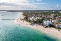
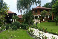
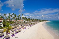
La Romana is located on the edge of the Caribbean Sea with some all-inclusive hotels, hotels, aparthotels and villas for vacations and weekends. This is where the famous Casa de Campo complex is located with its luxury villas, golf courses, marina and Alto de Chavon.
La Romana is also a stopover for cruise ships that visit the entire Caribbean. Dozens of boats stop each year with thousands of tourists who come to visit Alto de Chavón, Catalina island and Saona Island.
Tourism in La Romana is quite developed. The improvement of the road network has considerably reduced the distances. La Romana is only 1 hour drive from Santo Domingo.
In Santo Domingo, the Sichoem stop (Union of drivers and employees of minibuses) is the most economical way to go in Boca Chica.
Map from Santo Domingo Este to La Romana
Distances to other cities in the east of the Dominican Republic
- Distance from La Romana to Boca Chica: 53 miles
- Distance from La Romana to Bayahibe: 15.5 miles
- Distance from La Romana to Punta Cana: 46.6 miles
- Distance from La Romana to Higuey: 31 miles
- Distance from La Romana to Miches: 56 miles
- Distance from La Romana to Hato Mayor: 46.6 miles
More establishments in La Romana - Dominican Republic
